Science: Vegetation
In conjunction with aerial photography, remote sensing, and bathymetry, on-the-ground plant surveys provide information on biological responses to habitat restoration. Vegetation sampling is conducted during summer when vegetative cover is at its maximum. Permanent, 50-m point-intercept transects (1 m intervals) are established to determine the composition, height, and percent cover of plant species and to detect changes in vegetation through time. A 0.25 m2 quadrat is examined at the beginning, middle, and end of each transect (3 quadrats per transect) to estimate mean stem density, height, and ocular estimates of percent cover of each species. The location of target plants or invasive species (such as reed canary grass Phalaris arundinaceae) is tracked with Real-time Kinematic GPS ground surveys or high precision color infrared aerial photographs. Data are used to describe vegetation colonization and establishment (species composition, % cover, height, and density) compared to reference and older restorations in the Nisqually Delta.
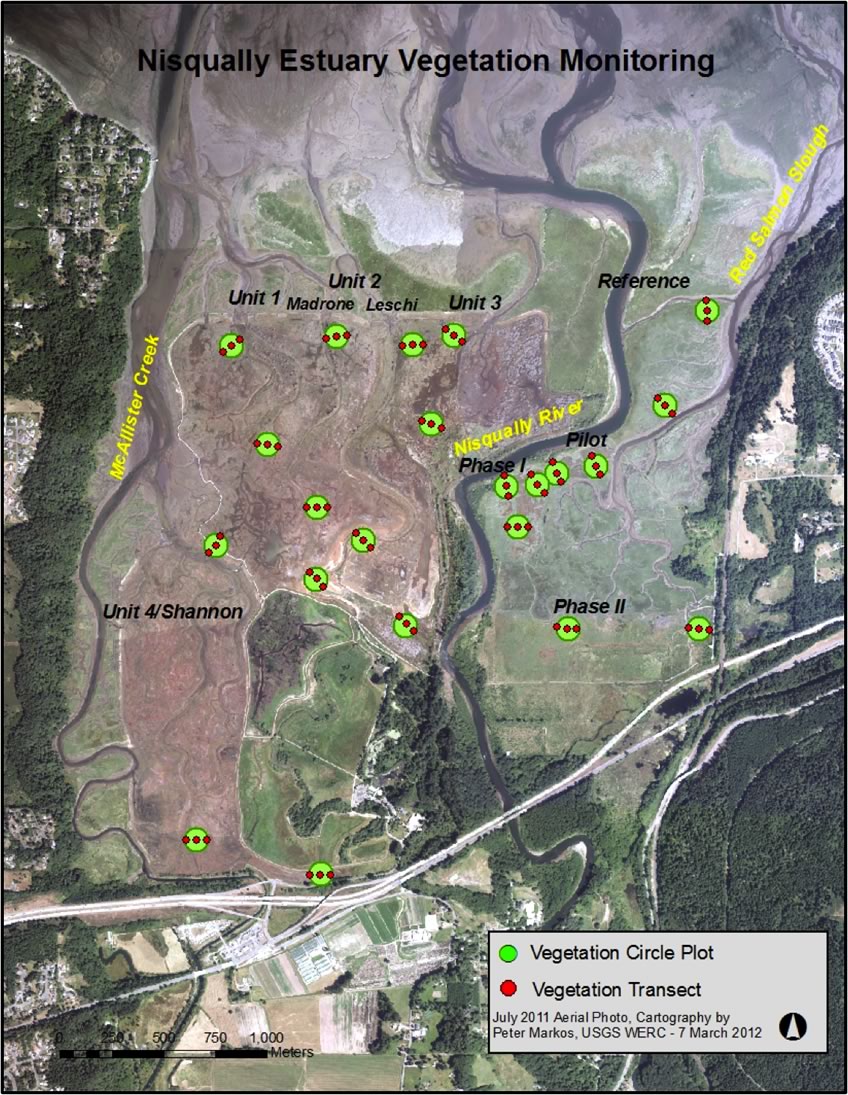
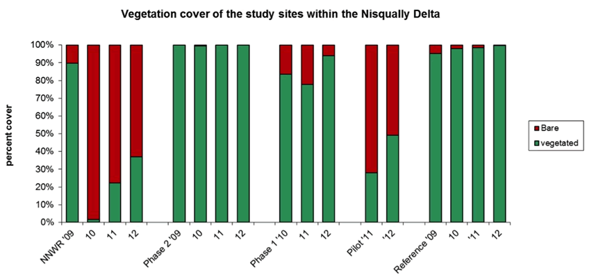
Figure 1: Relative percent vegetation cover along permanent vegetation transects from 2009 to 2012 by site NNWR (Nisqually National Wildlife Refuge restored in 2009, Phase 2 restored in 2006, Phase 1 restored in 2002, Pilot restored in 1996, and Reference (never tidally restricted). Vegetated category includes vascular vegetation and Bare category includes algae and bare ground.
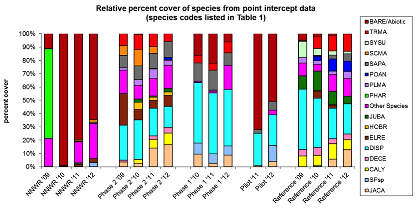
Figure 2: Relative percent cover along permanent vegetation transects from 2009 to 2012 by site NNWR (Nisqually National Wildlife Refuge restored in 2009, Phase 2 restored in 2006, Phase 1 restored in 2002, Pilot restored in 1996, and Reference (never tidally restricted). Between 2009-10 there was nearly a 100% reduction in the relative percent cover of the invasive reed canarygrass (PHAR) on NNWR. "Other" is comprised of species with < 5% relative cover : AGGI, AGsp, AGST, ALRU, ALTR, ATPA, CIVU, COCO, CUPA, ELAC, ELPA, ELsp, ELYM, FEAR, GAsp, GRIN, HOJU, HOLA, JUAC, JUAR, JUBO, JUBU, JUEF, LASE, LOCO, LYMA, MAFU, MOPA, PAVI, PHPR, POPU, POsp, PUNU, PUNU2, RACY, RUDI, RUMA, SARA, SCAC, SCAR, SODU, SPCA, and STHU (see Table 1 for species codes).
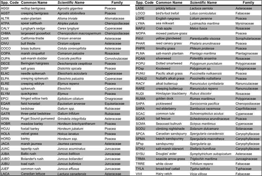
Table 1: All species observed throughout all sites and years during permanent vegetation surveys at the Nisqually Estuary (including both point intercept and quardrat surveys).